Description
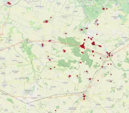
This dataset presents the results of EMS-98 building surveys, carried out by the Groupe d’intervention macrosismique (GIM/Epos-France: EOST UAR830 & ITES, RAP/ISterre, OMP/IRAP, IRSN) led by BCSF-Rénass from June 21 to 27, 2023 after the La Laigne earthquake of June 16, 2023 (M=5.3).
This fieldwork was conducted under the supervision of two macro-seismic experts from EDF (Aix-en-Provence) and CEA (Bruyères-le-Chatel).
This mainly concerned the EMS-98 degree of damage (from 1 to 5) associated with the EMS-98 seismic vulnerability (A to F) of the building.
For safety reasons, these assessments were carried out mainly from the street, according to the criteria of the EMS-98 European macro-seismic scale.
The damage to buildings in the two communes of La Laigne (17201) and Cram-Chaban (17132) was surveyed in full, while the other communes surveyed were sampled on the basis of the most significant damage indicated by the town halls in different vulnerability classes (department 17 : Benon, Bouhet, Courçon, Ferrières, La Grève-sur-Mignon, Landrais, Le Gué-d’Alleré, Marans, Saint-Georges-du-Bois, Saint-Jean-de-Liversay, Saint-Pierre-d’Amilly, Saint-Saturnin-du-Bois, Saint-Sauveur-d’Aunis, Surgères, Vouhé; department 79: Arçais, Mauzé-sur-le-Mignon, Saint-Hilaire-la-Palud).
Two post-processing operations were carried out, one to check that the appraised damage was not already present before the earthquake, using Google Street View images, and the other to confirm the degrees of damage and vulnerability estimated from the data collected by GIM.
The data is geolocated to an accuracy of 3 decimal places (location deviations of up to 100m are possible).
This dataset is a product of the BCSF-Rénass, a National Observation Service (SNO) labelled by the CNRS-INSU.

